 The Trishuli is named after the trishula or trident More than 60 per cent of the total drainage basin of the Trishuli lies in Tibet with about 9 per cent being covered by snow and glaciers. 85 per cent of its catchment area of 4,640 square kilometres (1,790 sq mi) lies above 3,000 metres (9,800 ft) out of which 11 per cent lies above 6,000 metres (20,000 ft). It has been regularly gauged at Betrawati at an elevation of 600 metres (2,000 ft). The average lowest and the melt season discharges of this river are close to average discharges recorded on the Narayani River.[1of Shiva, a powerful god in the Hindu pantheon,[2]There is a legend that says high in the Himalayas at Gosaikunda, Shiva drove his trident into the ground to create three springs – the source of the river and hence its name Trisuli.[3] In the Tibetan name, the suffix Tsangpo denotes a river flowing from or through Tsang, i.e. Tibet west of Lhas
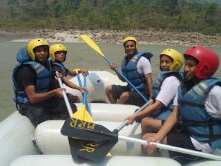
 Trisuli is Nepal’s most popular rafting river with impressive gorges,
exciting rapids, some easier sections and easy accessibility from Kathmandu and Pokhara.E asy access to the Prithivi Highway makes “breaking off” the journey easy. Chitwan National Park is also easily accessible
Trisuli is Nepal’s most popular rafting river with impressive gorges,
exciting rapids, some easier sections and easy accessibility from Kathmandu and Pokhara.E asy access to the Prithivi Highway makes “breaking off” the journey easy. Chitwan National Park is also easily accessibleThe Kali Gandaki or Gandaki River (also known as the Narayani in southern Nepal and the Gandak in India) is one of the major rivers of Nepal and a left bank tributary of the Ganges in India. It is also called Krishna Gandaki in Nepal.[1] In Nepal the river is notable for its deep gorge through the Himalayas and its enormous hydroelectric potential. It has a total catchment area of 46,300 square kilometers (17,900 sq mi), most of it in Nepal. The basin also contains 3 of the world's 14 highest mountains over 8,000m, the three being Dhaulagiri I, Manaslu and Annapurna I. Dhaulagiri I is the highest point of the Gandaki basin. It lies between the similar Kosi system to the east and the Karnali (Ghaghara) system to

 Gosaikunda, also spelled Gosainkunda and Gosain Kunda is an alpine freshwater oligotrophic lake in Nepal's Langtang National Park, located at an altitude of 4,380 m (14,370 ft) in the Rasuwa District with a surface of 13.8 ha (34 acres).[1] Together with associated lakes, the Gosaikunda Lake complex is 1,030 ha (4.0 sq mi) in size and has been designated a Ramsar site in September 2007.[2]
The lake melts and sips down to form the Trishuli River and remains frozen for six months in winter October to June. There are 108 lakes in this area, small to medium in size. The challenging Lauribina La pass at an altitude of 4,610 m (15,120 ft) is on its outskirts.
Marshyangdi (or Marsyangdi) is a mountain river in Nepal. Approximate length is 150 km. Marshyangdi is a tributary of Trishuli.
Marshyangdi starts from a confluence of two mountain rivers — Khangsar Khola and Jharsang Khola, that is located northwest of the Annapurna massif at an altitude of 3600 meters near Manang village. Marshyangdi flows eastward through the territory of Manang district and then southward through the territory of Lamjung district.
References
Over the last 250 years, the Kosi River has shifted its course over 120 km (75 mi) from east to west.[6] Its unstable nature has been attributed to the heavy silt it carries during the monsoon season and flooding in India has extreme effects. The Kosi River (The Sorrow of Bihar) is one of two major tributaries and the other river, the Gandak, drains the plains of north Bihar, India's most flood-prone area.[7] Fishing is an important enterprise on the river but fishing resources are being depleted and youth are leaving for other areas of work
awasome
ReplyDelete